
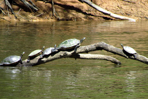
Land & Paddle Trails on the Haw River
Pittsboro, NC – Labor Day weekend is a good time to start thinking about Autumn. This Fall, I think I’d like to explore more of the Haw River, upstream from Chatham County.
All About the Haw River
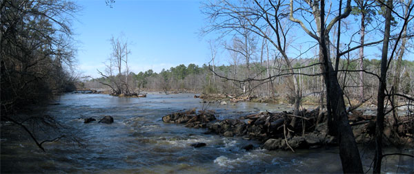
Most of us in Pittsboro and Eastern Chatham County know the Haw River where it flows through Bynum and down to Jordan Lake. There’s also some great paddling and hiking south of the lake where the Haw joins the Deep River to form the Cape Fear.
Last year, I wrote about Paddling the Middle and Lower Haw with quite a few links and resources.
But the Haw has it’s source about 70 miles north and west of Pittsboro in two natural springs in Forsyth County, according to Haw River Watershed Information, a project of Elon University Environmental Studies. It flows through Rockingham, Alamance and Orange counties before reaching Chatham County a few miles north of Bynum.
Fortunately, there are some great resources for discovering Upper Haw.
Land & Paddle Trails on the Upper Haw River
The best resource for land and paddle trails on the Upper Haw is an organization called The Haw Trail, a.k.a. TheHaw.org. Their mission:
The Haw River Trail is being built on the belief that the first step to conservation is appreciation and that allowing the public to experience the Haw River first hand via land a paddle trails will create interest and respect for the River.
To that end, their established a multi-city and county agreement to develop and protect the upper stretch of the Haw. Alamanace County has a Haw River Trail Coordinator as a permanent position.
Two great resources have been developed by The Haw Trail project:
- Land Trail Map
- Paddle Trail Map
Now I know where to go, where to put-in and what to expect.
Land Trails Map
The Land Trails Map is a “curated” Google Map with notes and trail visualizations.
Because it’s a Google Map, you can get instant directions from where you live to any marked point on the map.
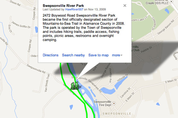
Visit the Haw River Land Trails Map
Paddle Trail Map
The Paddle Trail Map shows access points from Ossipee down to Jordan Lake with more than 25 notes.
Like the Land Trails Map, the Paddle map is a notated Google Map. You can plot directions to our from any point and get a route.
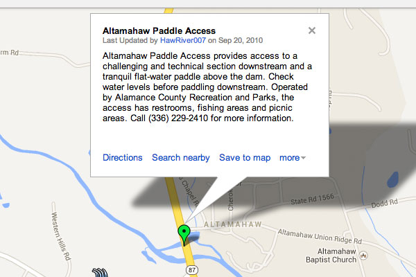
Visit the Haw River Paddle Trail Map
Mountain to Sea Trail
A related project is the Mountain-to-Sea Trail, traversing North Carolina from the Appalachians to the Outer Banks. Their motto is “a great way to discover North Carolina.” Portions of the MST Include the Haw River Trails.
I’m not ready to hike from Asheville to New Bern. But this autumn, I might explore more of the upper Haw.
And now, I have the resources to go do it.
Related
- Paddling The Haw River In Chatham County
Photos by Donald Lee Pardue, Todd Martin and bobistraveling.
Tags: Haw River, Hiking, Outdoors, Paddling, Recreation